Developing enterprise GIS system with centralized Geo-database for Madinah Municipality


Developing enterprise GIS system with centralized Geo-database for Madinah Municipality
The project includes a number of main tasks as follows:
Developing a centralized GIS system for the Municipality
Developing a centralized spatial geo-database according to the international standards
Designing spatial functions that can be published and distributed through different environments
Developing modern applications based on web environment according to latest web standard specifications
which aims to achieve the following goals:
Centralization of all procedures in the Municipality from databases through one system with unified global specifications, which provides high and unified quality for all services and data for all beneficiaries, By providing accurate, correct and up-to-date data.
Provide secure access to all resources and data through the new system.
Provide new functions that was not previously available, such as path analysis functions, indexed data search functions, and online services.
Scalability and extension of all parts of the system and its data, given the system’s application of international standards in basic infrastructure in developing the new system based on Services oriented architecture (SOA).
LOCATION
AL MADINAH
TYPE
DATA INFRASTUCTURE
Year
2010
Project Status
Completed
GTT prizes
GEOGRAPHIC TECHNOLOGIES TRADING
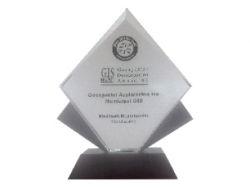
Geospatial DEVELOPMENT Awards
"Geospatial DEVELOPMENT Awards"
“Geospatial DEVELOPMENT Awards” in Geospatial Application for Municipal GIS from GIS DEVELOPMENT in the Middle East.
© 2020 DESIGN AND DEVOLPED BY KIAN
© 2020 all right reserved to GEOGRAPHIC TECHNOLOGIES TRADING


