Spatial enhancement of Makkah parcels data project
Spatial enhancement of Makkah parcels data project
The project aims to update the parcels data in Makkah according to the international GIS standards. This is done through collecting accurate spatial data and studying the current status of parcel and reseolving any convelects in the parcel plans, which includes (approved plans for land divisions, regulation plans, survey krokie’s data, and unplanned areas plans), then work on assessing the validity and accuracy of spatial data, conducting correction and processing of plans and data, then designing a database depending on the International Standards, and compatible with Municipality’s data model, and then implementing the correction methodology for maps and plans, whether in office or through field surveying, and to convert data to GIS digital format then load those data into the final DB. The project also includes the development of modern procedures and technical specifications for receiving and accepting Krokie’s regulation plans submitted by consulting engineering offices.
LOCATION
MAKKAH
TYPE
DATA INFRASTUCTURE
Year
2014
Project Status
Completed
Equipment used to perform the service


GTT Partners
GEOGRAPHIC TECHNOLOGIES TRADING
This is what we’ve been working on

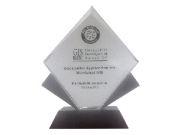
GTT prizes
GEOGRAPHIC TECHNOLOGIES TRADING
Geospatial DEVELOPMENT Awards
"Geospatial DEVELOPMENT Awards"
“Geospatial DEVELOPMENT Awards” in Geospatial Application for Municipal GIS from GIS DEVELOPMENT in the Middle East.
Phones
+966 55 304 8855
+966 50 995 1522
+966 55 099 9551
Email : info@gtt.com.sa
© 2020 DESIGN AND DEVOLPED BY KIAN
© 2020 all right reserved to GEOGRAPHIC TECHNOLOGIES TRADING